2011
SU8668 : Westerly Point, Bracknell
taken 13 years ago, near to Bracknell, Bracknell Forest, England
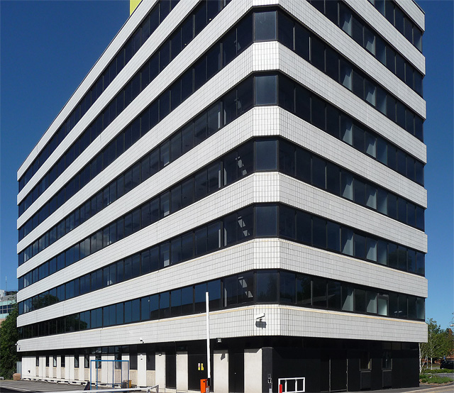
Westerly Point, Bracknell
A block of 1970-71 by the Bracknell Development Corporation with bands of white tiles and continuous windows creating an assertively stripey look.
The current name is probably a rebranding. The fashion seems to be to have two-word titles, one of them being "point" or "tower".
The current name is probably a rebranding. The fashion seems to be to have two-word titles, one of them being "point" or "tower".
 Map © Crown Copyright")
TIP: Click the map for more Large scale mapping
- Grid Square
- SU8668, 49 images (more nearby 🔍)
- Photographer
- Stephen Richards (more nearby)
- Date Taken
- Sunday, 26 June, 2011 (more nearby)
- Submitted
- Wednesday, 18 January, 2012
- Subject Location
-
OSGB36:
 SU 8679 6899 [10m precision]
WGS84: 51:24.7978N 0:45.2054W - Camera Location
-
OSGB36: SU 8677 6897
- View Direction
- Northeast (about 45 degrees)