2012
NZ8811 : A lovely stretch of the Cleveland Way
taken 12 years ago, near to Sandsend, North Yorkshire, England
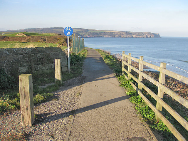
A lovely stretch of the Cleveland Way
Heading towards Upgang beach from Whitby. To the left is the golf course and dismantled railway. Ahead is Sandsend Ness.
 Map © Crown Copyright")
TIP: Click the map for more Large scale mapping
- Grid Square
- NZ8811, 136 images (more nearby 🔍)
- Photographer
- Pauline E (more nearby)
- Date Taken
- Monday, 16 January, 2012 (more nearby)
- Submitted
- Thursday, 19 January, 2012
- Subject Location
-
OSGB36:
 NZ 8825 1189 [10m precision]
WGS84: 54:29.6804N 0:38.3397W - Camera Location
-
OSGB36: NZ 88298 11876
- View Direction
- West-northwest (about 292 degrees)