2012
NN8705 : View from Tambeth Hill
taken 12 years ago, 4 km SSW of Blackford, Perth And Kinross, Scotland
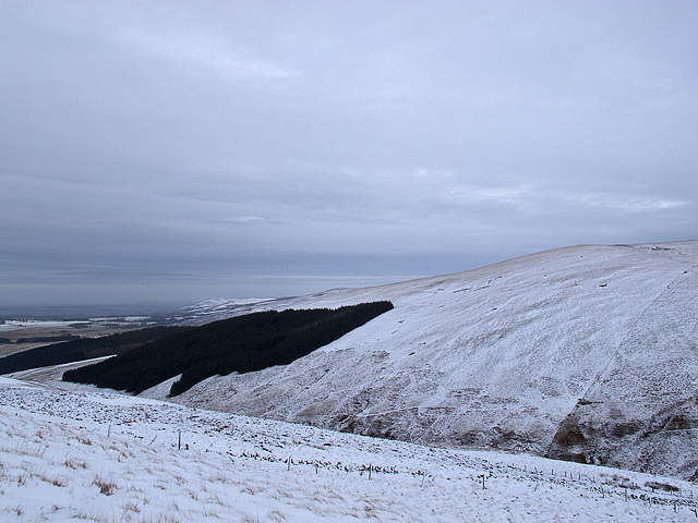
View from Tambeth Hill
A view to the north-east from Tambeth Hill, with forestry plantations on Berry Hill visible in the distance. Land use here is predominantly agricultural, with most land used as rough grazing.
 Map © Crown Copyright")
TIP: Click the map for more Large scale mapping
- Grid Square
- NN8705, 5 images (more nearby 🔍)
- Photographer
- William Starkey (more nearby)
- Date Taken
- Friday, 20 January, 2012 (more nearby)
- Submitted
- Friday, 20 January, 2012
- Subject Location
-
OSGB36:
 NN 878 054 [100m precision]
WGS84: 56:13.6895N 3:48.6122W - Camera Location
-
OSGB36: NN 877 053
- View Direction
- East-northeast (about 67 degrees)