2012
NS4076 : Barloan Toll Roundabout
taken 12 years ago, near to Bellsmyre, West Dunbartonshire, Scotland
This is 1 of 3 images, with title starting with Barloan in this square
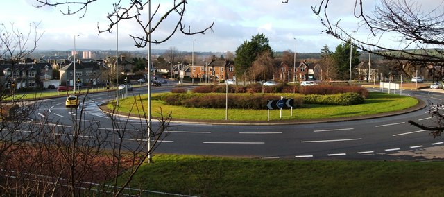
Barloan Toll Roundabout
The picture was taken from a path that leads up into Bellsmyre. As the name suggests, Barloan Toll was located on the boundary of the burgh.
When trams were running in Dumbarton (from 1907 to 1928), there was a branch line to Barloan Toll (now the site of the roundabout). The branch line left the main line at Church Place (beside NS3975 : Dumbarton Riverside Parish Church) and followed NS3975 : Church Street, Dumbarton, Strathleven Place, and NS4075 : Bonhill Road [see "Dumbarton's Trams and Buses", A.W.Brotchie and R.L.Grieves, 1985].
Compare NS3875 : The former site of Dalreoch Toll.
 Map © Crown Copyright")
TIP: Click the map for more Large scale mapping
- Grid Square
- NS4076, 150 images (more nearby 🔍)
- Photographer
- Lairich Rig (more nearby)
- Date Taken
- Monday, 9 January, 2012 (more nearby)
- Submitted
- Friday, 20 January, 2012
- Subject Location
-
OSGB36:
 NS 4054 7630 [10m precision]
WGS84: 55:57.1910N 4:33.3299W - Camera Location
-
OSGB36: NS 4060 7630
- View Direction
- WEST (about 270 degrees)