2012
NT7447 : Disused Pumping Station
taken 12 years ago, 3 km from Polwarth, Scottish Borders, Scotland
This is 1 of 2 images, with title Disused Pumping Station in this square
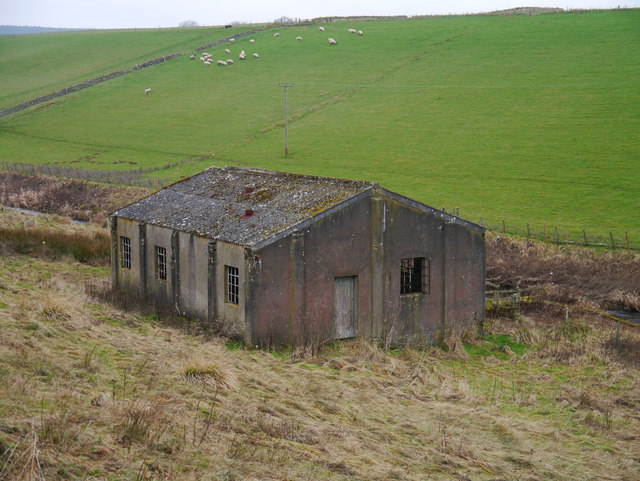
Disused Pumping Station
A view of the remains of the pumping station. According to RAF plans, a water tower was positioned uphill from this site at Dispersed Site No 8.
RAF Charterhall
A selection of images of the remains of RAF Charterhall and associated structures.
 Map © Crown Copyright")
TIP: Click the map for more Large scale mapping
- Grid Square
- NT7447, 20 images (more nearby 🔍)
- Photographer
- James T M Towill (more nearby)
- Date Taken
- Saturday, 14 January, 2012 (more nearby)
- Submitted
- Sunday, 22 January, 2012
- Subject Location
-
OSGB36:
 NT 7454 4702 [10m precision]
WGS84: 55:42.9560N 2:24.4086W - Camera Location
-
OSGB36: NT 7456 4702
- View Direction
- West-northwest (about 292 degrees)