2012
NN3105 : Boggy path on Cruach Tairbeirt
taken 12 years ago, near to Tarbet, Argyll And Bute, Scotland
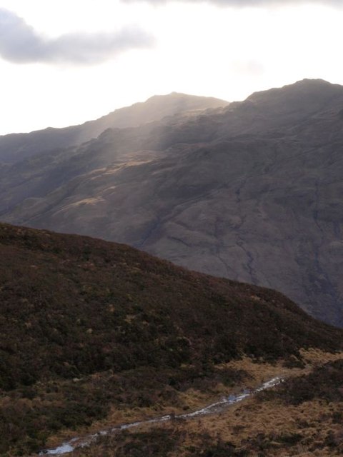
Boggy path on Cruach Tairbeirt
The passage of many feet has worn a path to the top of Cruach Tairbeirt. In winter it is probably normal to find it resembling a little boggy stream, as today (in the foreground). Ben Reoch at the north-east end of the Luss Hills lies beyond.
 Map © Crown Copyright")
TIP: Click the map for more Large scale mapping
- Grid Square
- NN3105, 14 images (more nearby 🔍)
- Photographer
- Alec MacKinnon (more nearby)
- Date Taken
- Sunday, 22 January, 2012 (more nearby)
- Submitted
- Sunday, 22 January, 2012
- Subject Location
-
OSGB36:
 NN 3121 0558 [10m precision]
WGS84: 56:12.7661N 4:43.3940W - Camera Location
-
OSGB36: NN 3121 0559
- View Direction
- SOUTH (about 180 degrees)