2012
J3569 : Cavanagh "Python" access cover, Belfast
taken 12 years ago, 5 km NNW of Carryduff, Co Down, Northern Ireland
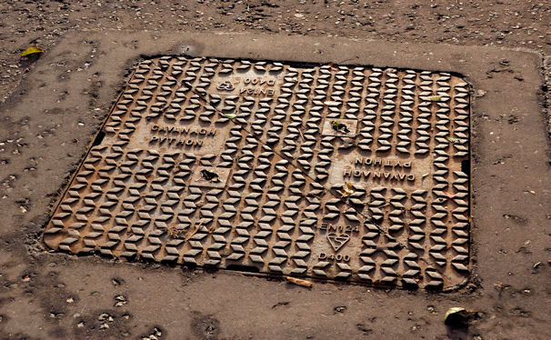
Cavanagh "Python" access cover, Belfast
Continuing the series of named Cavanagh access covers Link this example of a Python is on the Saintfield Road, on the outward side of the School Road.
Manhole covers, foundry products etc, Northern Ireland
A series of photographs showing manhole covers, fire hydrants, gratings, foundry products, foundry plaques and inscriptions etc, in Northern Ireland.
Loading map... (JavaScript required)
- Grid Square
- J3569, 47 images (more nearby 🔍)
- Photographer
- Albert Bridge (more nearby)
- Date Taken
- Monday, 23 January, 2012 (more nearby)
- Submitted
- Monday, 23 January, 2012
- Subject Location
-
Irish:
 J 353 695 [100m precision]
WGS84: 54:33.3799N 5:54.4913W - Camera Location
-
Irish: J 353 695
- View Direction
- South-southeast (about 157 degrees)