2011
SW6747 : Sally's Bottom
taken 12 years ago, near to Porthtowan, Cornwall, England
This is 1 of 3 images, with title Sally's Bottom in this square
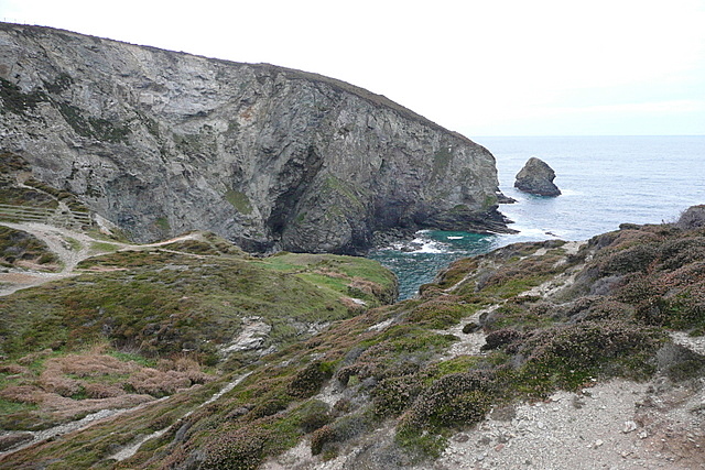
Sally's Bottom
A view from the coastal path looking into the Cove called Sally's Bottom, with Gullyn Rock beyond. There is a lot of evidence of mining activity in the area.
 Map © Crown Copyright")
TIP: Click the map for more Large scale mapping
- Grid Square
- SW6747, 21 images (more nearby 🔍)
- Photographer
- Graham Horn (more nearby)
- Date Taken
- Friday, 21 October, 2011 (more nearby)
- Submitted
- Tuesday, 24 January, 2012
- Subject Location
-
OSGB36:
 SW 675 470 [100m precision]
WGS84: 50:16.6243N 5:15.8721W - Camera Location
-
OSGB36: SW 6787 4701
- View Direction
- WEST (about 270 degrees)