1998
SJ3661 : The Red Lion, Dodleston
taken 26 years ago, near to Dodleston, Cheshire West And Chester, England
This is 1 of 2 images, with title starting with The Red Lion in this square
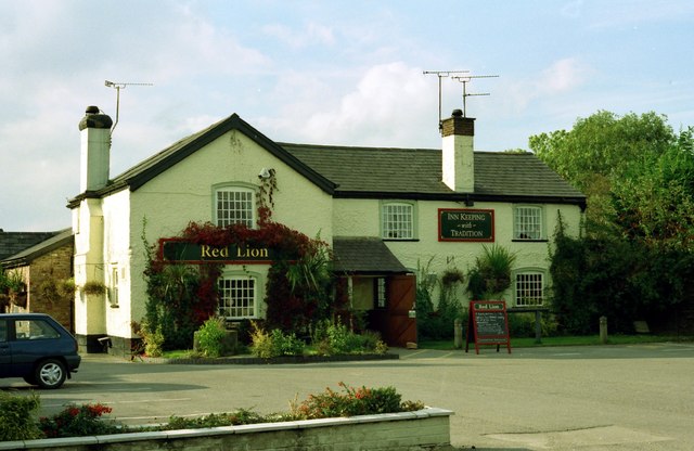
The Red Lion, Dodleston
A bit of history from the pub's website:
An 18th Century map suggests The Red Lion was established as far back as 1737, though then it was known as "The Red Lyon". Our quiet and peaceful history was interrupted in the autumn of 1845 when the inn became the scene of a battle between angry Irish and English farm labourers.
An 18th Century map suggests The Red Lion was established as far back as 1737, though then it was known as "The Red Lyon". Our quiet and peaceful history was interrupted in the autumn of 1845 when the inn became the scene of a battle between angry Irish and English farm labourers.
 Map © Crown Copyright")
TIP: Click the map for more Large scale mapping
- Grid Square
- SJ3661, 11 images (more nearby 🔍)
- Photographer
- Jeff Buck (more nearby)
- Date Taken
- June 1998 (more nearby)
- Submitted
- Friday, 27 January, 2012
- Subject Location
-
OSGB36:
 SJ 3611 6107 [10m precision]
WGS84: 53:8.5757N 2:57.3966W - Camera Location
-
OSGB36: SJ 3615 6107
- View Direction
- WEST (about 270 degrees)