2011
NM5849 : Tree covered mound near Killundine
taken 13 years ago, near to Killundine, Highland, Scotland
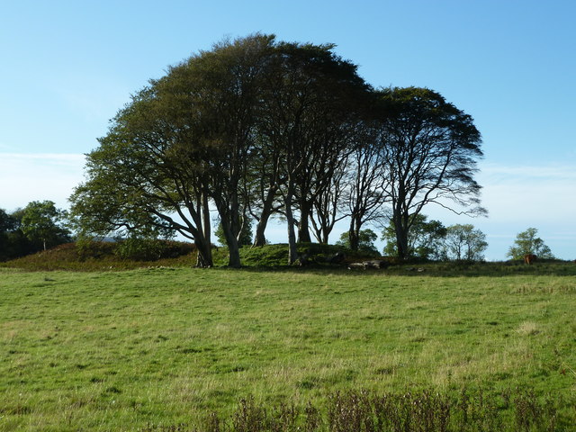
Tree covered mound near Killundine
This tree-covered circular mound hardly gets a mention on OS maps. It is very similar to the mound at Pitnacree, Perthshire. There must be someone out there who knows something of the archaeology of this place. In general, the earthen mounds and circles of Scotland tend to get less attention than their stone relatives.
 Map © Crown Copyright")
TIP: Click the map for more Large scale mapping
- Grid Square
- NM5849, 8 images (more nearby 🔍)
- Photographer
- Peter Bond (more nearby)
- Date Taken
- Sunday, 2 October, 2011 (more nearby)
- Submitted
- Saturday, 28 January, 2012
- Subject Location
-
OSGB36:
 NM 5828 4904 [10m precision]
WGS84: 56:34.2519N 5:56.1965W - Camera Location
-
OSGB36: NM 5835 4907
- View Direction
- West-southwest (about 247 degrees)