2012
NN9249 : Balnaguard Burn tributary route
taken 12 years ago, 3 km from Little Ballinluig, Perth And Kinross, Scotland
Balnaguard Burn tributary route
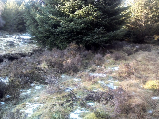
The burn shown on the 1:50000 map is in the cutting on the left. The point of the picture is to show the nature of the forest at this point which is the obvious short route between the two forest tracks. It is reasonably open compared with the mostly very dense forest in this area, so progress can be made by keeping quite close to the burn.
 Map © Crown Copyright")
TIP: Click the map for more Large scale mapping
- Grid Square
- NN9249, 5 images (more nearby 🔍)
- Photographer
- AllanKnaik (more nearby)
- Date Taken
- Monday, 23 January, 2012 (more nearby)
- Submitted
- Sunday, 29 January, 2012
- Subject Location
-
OSGB36:
 NN 9231 4931 [10m precision]
WGS84: 56:37.3933N 3:45.4023W - Camera Location
-
OSGB36: NN 9234 4931
- View Direction
- West-southwest (about 247 degrees)