2011
SY5889 : Strip Lynchets, Littlebredy
taken 12 years ago, near to Littlebredy, Dorset, England
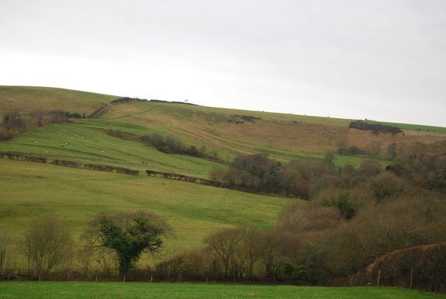
Strip Lynchets, Littlebredy
A lynchet is a bank of earth that builds up on the downslope of a field ploughed over a long period of time. The disturbed soil slips down the hillside to create a lynchet They are also referred to as strip lynchets.
They are a feature of ancient field systems such as the Celtic field systems. Some believe that they were passively formed under the long-term action of gravity and weathering (soil creep) on the loosened soil of a ploughed slope, while others believe they may have been intentionally formed, to prevent erosion and slippage of the ploughed slope.
See other images of Lynchets (Strip Lynchets)
 Map © Crown Copyright")
TIP: Click the map for more Large scale mapping
- Grid Square
- SY5889, 109 images (more nearby 🔍)
- Photographer
- N Chadwick (more nearby)
- Date Taken
- Wednesday, 28 December, 2011 (more nearby)
- Submitted
- Monday, 30 January, 2012
- Subject Location
-
OSGB36:
 SY 5829 8985 [10m precision]
WGS84: 50:42.4069N 2:35.5230W - Camera Location
-
OSGB36: SY 5807 8916
- View Direction
- North-northeast (about 22 degrees)