2012
SO0205 : Mynydd Aberdar
taken 12 years ago, near to Abernant, Rhondda Cynon Taf, Wales
Mynydd Aberdar
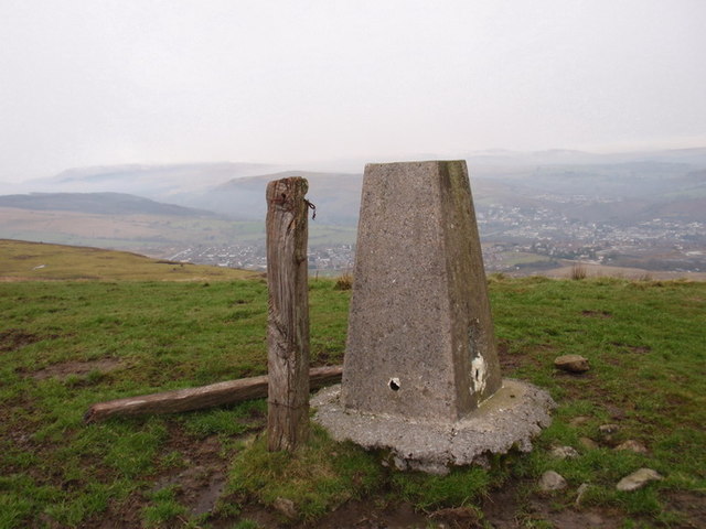
Piler trinogli ar Fynydd Aberdar. I'r dwyrain ohono y mae tref Merthyr Tudful ac i'r de y mae Aberdar. Ceir hefyd olygfeydd ysblenydd oddi yma o Ben y Fan, mynydd uchaf De Cymru
Trig point on Mynydd Aberdar. The town of Merthyr Tydful i located to the east and Aberdar lies to the south. The peak also offers fine views on Pen y Fan, the highest mountain in Wales.
Trig point on Mynydd Aberdar. The town of Merthyr Tydful i located to the east and Aberdar lies to the south. The peak also offers fine views on Pen y Fan, the highest mountain in Wales.
 Map © Crown Copyright")
TIP: Click the map for more Large scale mapping
- Grid Square
- SO0205, 22 images (more nearby 🔍)
- Photographer
- Alan Richards (more nearby)
- Date Taken
- Sunday, 29 January, 2012 (more nearby)
- Submitted
- Monday, 30 January, 2012
- Subject Location
-
OSGB36:
 SO 0206 0557 [10m precision]
WGS84: 51:44.4148N 3:25.1906W - Camera Location
-
OSGB36: SO 0208 0555
- View Direction
- North-northwest (about 337 degrees)