2011
SS8942 : Path junction on Dunkery Hill
taken 12 years ago, 3 km from Luccombe, Somerset, England
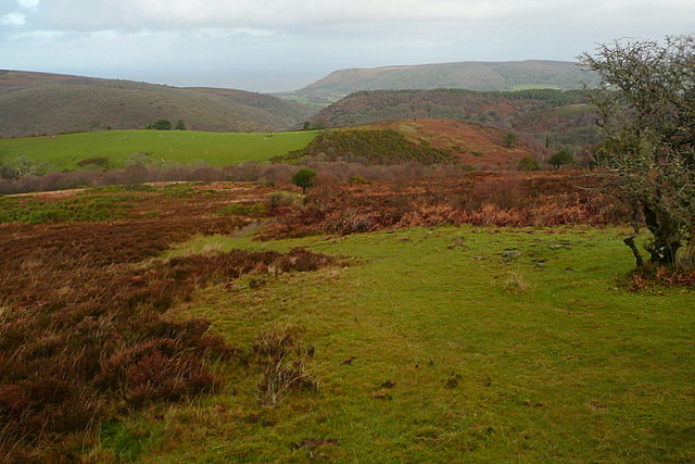
Path junction on Dunkery Hill
A key point where a south-north path coming off Dunkery Beacon meets the west-east path that contours around the north-facing combes. This view looks north towards, successively, Cloutsham Ball, Horner Hill and Bossington Hill.
 Map © Crown Copyright")
TIP: Click the map for more Large scale mapping
- Grid Square
- SS8942, 46 images (more nearby 🔍)
- Photographer
- Graham Horn (more nearby)
- Date Taken
- Wednesday, 28 December, 2011 (more nearby)
- Submitted
- Tuesday, 31 January, 2012
- Subject Location
-
OSGB36:
 SS 895 426 [100m precision]
WGS84: 51:10.3158N 3:34.9189W - Camera Location
-
OSGB36: SS 8957 4257
- View Direction
- North-northwest (about 337 degrees)