TQ5839 : Wells Tunnel, Tunbridge Wells Station
taken 12 years ago, near to Royal Tunbridge Wells, Kent, England
The Hastings Line links Hastings with Tunbridge Wells and Tonbridge, then onto London Charing Cross. The line was built by the South Eastern Railway (SER) and opened fully in 1853, having been constructed in phases. Tonbridge to Tunbridge Wells opened in 1846. Tunbridge Wells to Robertsbridge opened in 1851. Robertsbridge to Battle 1852 and Battle to St Leonards (Bo Peep Junction) 1853. The line was built very quickly (and not very well) and several of the tunnels need constant maintenance even today, several of them are single track.
Wikipedia: Link
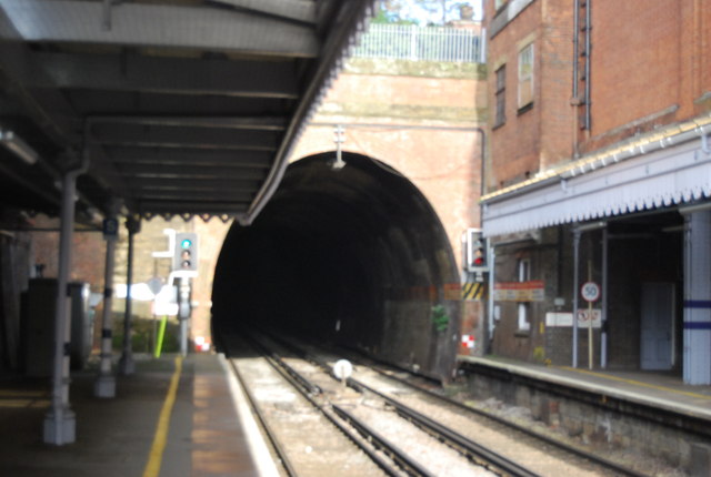
Tunbridge Wells Station was opened by the South Eastern Railway (SER) on 25th November 1846. It is on "the Hastings line" ( Link ). The station is a cut station with access in both directions by tunnels, the Grove Tunnel from the south and the Wells Tunnel from the north.
The station has a regular service to both London Charing Cross and Hastings as well as shuttles to Tonbridge and some to London Bridge via Redhill.
A Grade II listed building. Link
 Map © Crown Copyright")
- Grid Square
- TQ5839, 5499 images (more nearby 🔍)
- Photographer
- N Chadwick (more nearby)
- Date Taken
- Saturday, 19 November, 2011 (more nearby)
- Submitted
- Wednesday, 1 February, 2012
- Subject Location
-
OSGB36:
 TQ 5844 3926 [10m precision]
WGS84: 51:7.8423N 0:15.7803E - Camera Location
-
OSGB36: TQ 5843 3923
- View Direction
- NORTH (about 0 degrees)