2012
NT7544 : Thirlington Burn
taken 12 years ago, near to Lambden, Scottish Borders, Scotland
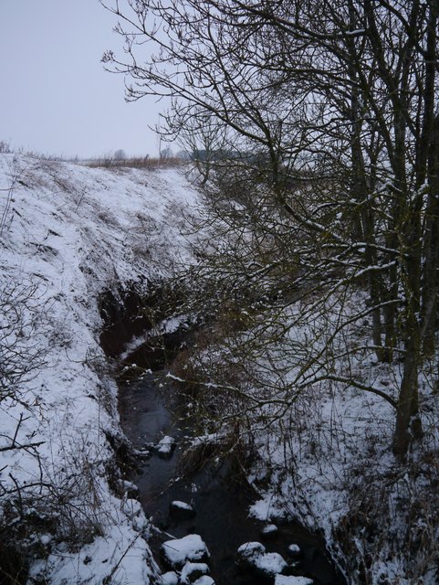
Thirlington Burn
Taking its name from a dwelling which used to stand near the junction of the A697 and road to Eccles Tofts to the north, this burn flows from Gordonbank to Ploughlands where there is a confluence with the Lambden Burn.
 Map © Crown Copyright")
TIP: Click the map for more Large scale mapping
- Grid Square
- NT7544, 17 images (more nearby 🔍)
- Photographer
- James T M Towill (more nearby)
- Date Taken
- Saturday, 4 February, 2012 (more nearby)
- Submitted
- Saturday, 4 February, 2012
- Subject Location
-
OSGB36:
 NT 7503 4413 [10m precision]
WGS84: 55:41.3995N 2:23.9248W - Camera Location
-
OSGB36: NT 7503 4413
- View Direction
- North-northeast (about 22 degrees)