2012
SE0110 : The Pennine Way at Millstone Edge
taken 12 years ago, near to Bleak Hey Nook, Oldham, England
This is 1 of 2 images, with title The Pennine Way at Millstone Edge in this square
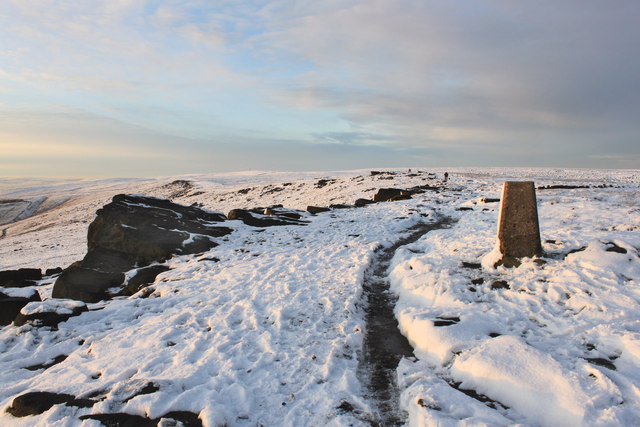
The Pennine Way at Millstone Edge
The trig point is a well known feature of this stretch of the Pennine Way.
 Map © Crown Copyright")
TIP: Click the map for more Large scale mapping
- Grid Square
- SE0110, 40 images (more nearby 🔍)
- Photographer
- Michael Fox (more nearby)
- Date Taken
- Saturday, 28 January, 2012 (more nearby)
- Submitted
- Saturday, 4 February, 2012
- Subject Location
-
OSGB36:
 SE 0105 1067 [10m precision]
WGS84: 53:35.5564N 1:59.1366W - Camera Location
-
OSGB36: SE 0121 1053
- View Direction
- Northwest (about 315 degrees)