2010
SO6209 : New Fancy Geomap
taken 14 years ago, near to Parkend, Gloucestershire, England
New Fancy Geomap
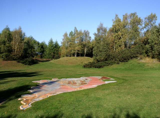
The Forest of Dean Geomap, a 900 square feet (84 m2) sculpture of the geology and mines of the Forest of Dean area, was unveiled at the New Fancy picnic site in May 2008. It was commissioned by the local history society, who received a grant from DEFRAs Aggregates Levy Sustainability Fund, and was constructed by sculptor David Yeates of Mitcheldean before being assembled on site. The rock strata depicted are built from samples of the rock they represent. Metal discs represent the locations of the main iron and coal mines and quarries, with black lines to represent coal seams and white lines for railway routes. It is flat and polished, but not shiny, and is intended to be walked on.
Thanks to Wikipedia for that extract.
Thanks to Wikipedia for that extract.
 Map © Crown Copyright")
TIP: Click the map for more Large scale mapping
- Grid Square
- SO6209, 67 images (more nearby 🔍)
- Photographer
- Des Blenkinsopp (more nearby)
- Date Taken
- Sunday, 10 October, 2010 (more nearby)
- Submitted
- Sunday, 5 February, 2012
- Subject Location
-
OSGB36:
 SO 6282 0952 [10m precision]
WGS84: 51:46.9859N 2:32.4223W - Camera Location
-
OSGB36: SO 6282 0951
- View Direction
- North-northwest (about 337 degrees)