2011
SJ9214 : Church Farm in Penkridge, Staffordshire
taken 13 years ago, near to Penkridge, Staffordshire, England
This is 1 of 2 images, with title Church Farm in Penkridge, Staffordshire in this square
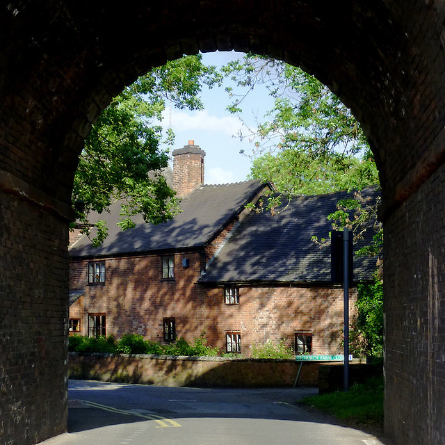
Church Farm in Penkridge, Staffordshire
The former farmhouse is seen here from beneath the railway arch in Pinfold Lane. The farm is probably fifteenth century, with early eighteenth century additions (this end) and rebuilding. The red brick has replaced earlier timber framing.
 Map © Crown Copyright")
TIP: Click the map for more Large scale mapping
- Grid Square
- SJ9214, 254 images (more nearby 🔍)
- Photographer
- Roger D Kidd (more nearby)
- Date Taken
- Tuesday, 24 May, 2011 (more nearby)
- Submitted
- Monday, 6 February, 2012
- Subject Location
-
OSGB36:
 SJ 920 142 [100m precision]
WGS84: 52:43.5232N 2:7.1162W - Camera Location
-
OSGB36: SJ 920 142
- View Direction
- EAST (about 90 degrees)