2011
TR2060 : Ditch, Westbere Marshes
taken 12 years ago, near to Westbere, Kent, England
This is 1 of 3 images, with title Ditch, Westbere Marshes in this square
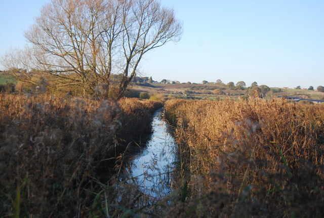
Ditch, Westbere Marshes
Westbere Marshes is an extensive 95 acre wetland reserve consisting primarily of a reedbed (Phragmites australis), interspersed by ditches, ponds and willows. On the southern boundary of the site lies the River Great Stour. This mixture of habitats attracts a wide variety of wildlife.
Westbere Marshes form an integral part of the Stodmarsh SSSI, and make an important contribution to the nearby Stodmarsh National Nature Reserve.
See other images of Westbere Marshes (Westbere Reserve)
Westbere Marshes form an integral part of the Stodmarsh SSSI, and make an important contribution to the nearby Stodmarsh National Nature Reserve.
See other images of Westbere Marshes (Westbere Reserve)
 Map © Crown Copyright")
TIP: Click the map for more Large scale mapping
- Grid Square
- TR2060, 35 images (more nearby 🔍)
- Photographer
- N Chadwick (more nearby)
- Date Taken
- Saturday, 19 November, 2011 (more nearby)
- Submitted
- Tuesday, 7 February, 2012
- Subject Location
-
OSGB36:
 TR 2011 6067 [10m precision]
WGS84: 51:18.1544N 1:9.3767E - Camera Location
-
OSGB36: TR 2011 6063
- View Direction
- North-northwest (about 337 degrees)