2011
ST2859 : Brean Down - Brean Down Fort Barrack Block
taken 13 years ago, 4 km NNW of Brean, Somerset, England
This is 1 of 4 images, with title Brean Down - Brean Down Fort Barrack Block in this square
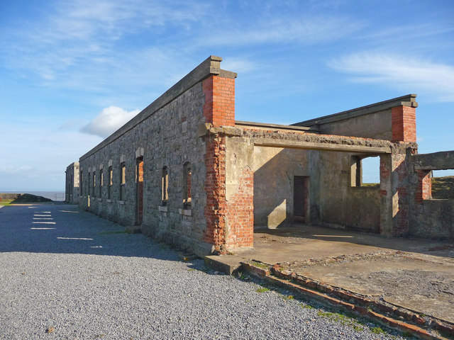
Brean Down - Brean Down Fort Barrack Block
Brean Down Fort was built in the 1860s as part of the Bristol Channel defences. Along with Flat Holm and Steep Holm islands and batteries on the Wales side, a direct line of defences was formed to protect the docks. Brean Down Fort is located at the furthest point of Brean Down, just South of Western-Super-Mare in Somerset. It was originally armed with seven 7-inch guns, and later re-armed in WW2. It was partially destroyed at the beginning of the twentieth century by an explosion in the magazine, leaving some parts derelict.
 Map © Crown Copyright")
TIP: Click the map for more Large scale mapping
- Grid Square
- ST2859, 153 images (more nearby 🔍)
- Photographer
- Chris Talbot (more nearby)
- Date Taken
- Wednesday, 19 October, 2011 (more nearby)
- Submitted
- Tuesday, 7 February, 2012
- Subject Location
-
OSGB36:
 ST 280 592 [100m precision]
WGS84: 51:19.6393N 3:2.0845W - Camera Location
-
OSGB36: ST 280 592
- View Direction
- Northeast (about 45 degrees)