2011
SK2265 : Shining Bank Quarry, between Bakewell and Youlgreave, Derbyshire
taken 13 years ago, near to Alport, Derbyshire, England
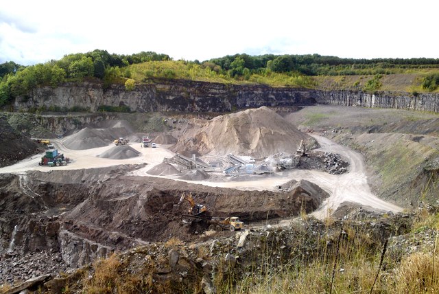
Shining Bank Quarry, between Bakewell and Youlgreave, Derbyshire
For a quarry that was closing with the loss of all 16 jobs in 2005, and where much reclamation work followed, it seemed to be very active in September 2011.
Looks like this may be going for roadstone?
Looks like this may be going for roadstone?
 Map © Crown Copyright")
TIP: Click the map for more Large scale mapping
- Grid Square
- SK2265, 36 images (more nearby 🔍)
- Photographer
- Chris Morgan (more nearby)
- Date Taken
- Wednesday, 7 September, 2011 (more nearby)
- Submitted
- Thursday, 9 February, 2012
- Subject Location
-
OSGB36:
 SK 2271 6509 [10m precision]
WGS84: 53:10.9457N 1:39.6980W - Camera Location
-
OSGB36: SK 2297 6525
- View Direction
- West-southwest (about 247 degrees)