2012
SK9871 : Stamp End Lock
taken 12 years ago, near to Lincoln, Lincolnshire, England
This is 1 of 5 images, with title Stamp End Lock in this square
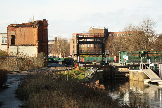
Stamp End Lock
Guillotine lock and sluice on the Witham at Stamp End. The first lock here in the 1770s replaced a toll chain across the river, renewed in 1812 and superseded by the current lock in 1950
 Map © Crown Copyright")
TIP: Click the map for more Large scale mapping
- Grid Square
- SK9871, 451 images (more nearby 🔍)
- Photographer
- Richard Croft (more nearby)
- Date Taken
- Saturday, 28 January, 2012 (more nearby)
- Submitted
- Friday, 10 February, 2012
- Subject Location
-
OSGB36:
 SK 9828 7107 [10m precision]
WGS84: 53:13.6554N 0:31.7550W - Camera Location
-
OSGB36: SK 9830 7106
- View Direction
- West-northwest (about 292 degrees)