2007
SD8771 : Limestone outcropping along line of shake holes
taken 17 years ago, 4 km SW of Litton, North Yorkshire, England
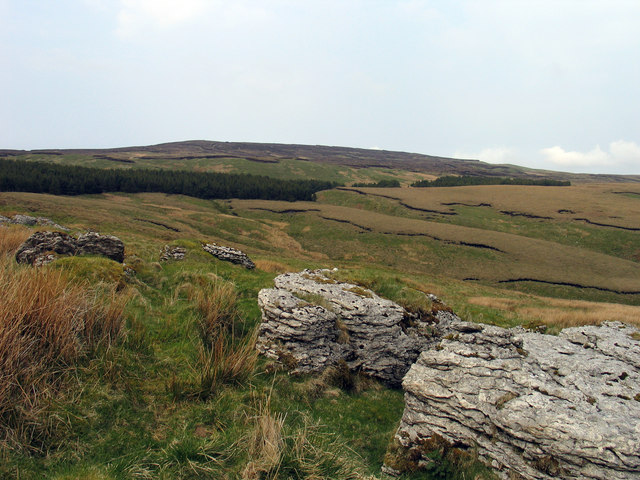
Limestone outcropping along line of shake holes
Beyond the outcropping limestone there are several stream grooves - Darnbrook Beck and tributaries. The hill beyond the coniferous plantations is Darnbrook Fell.
 Map © Crown Copyright")
TIP: Click the map for more Large scale mapping
- Grid Square
- SD8771, 17 images (more nearby 🔍)
- Photographer
- Trevor Littlewood (more nearby)
- Date Taken
- Friday, 27 April, 2007 (more nearby)
- Submitted
- Friday, 10 February, 2012
- Subject Location
-
OSGB36:
 SD 8788 7156 [10m precision]
WGS84: 54:8.3839N 2:11.2206W - Camera Location
-
OSGB36: SD 8788 7154
- View Direction
- NORTH (about 0 degrees)