2011
SP1263 : Arable field south of Upper Wawensmoor
taken 13 years ago, near to Morton Bagot, Warwickshire, England
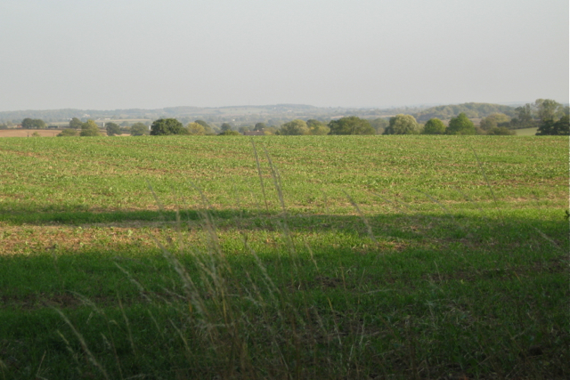
Arable field south of Upper Wawensmoor
The relatively high viewpoint (for Arden 100 metres) allows a view across the wide valley of the River Alne. On the skyline, centre, is Austy Wood, in SP1662 and neighbouring squares. The wooded knoll on the right is believed to be Roundhill Coppice in SP1461.
 Map © Crown Copyright")
TIP: Click the map for more Large scale mapping
- Grid Square
- SP1263, 13 images (more nearby 🔍)
- Photographer
- Robin Stott (more nearby)
- Date Taken
- Monday, 3 October, 2011 (more nearby)
- Submitted
- Friday, 10 February, 2012
- Subject Location
-
OSGB36:
 SP 1246 6383 [10m precision]
WGS84: 52:16.3491N 1:49.1290W - Camera Location
-
OSGB36: SP 1227 6397
- View Direction
- Southeast (about 135 degrees)