2012
TQ1654 : A pool along the course of the River Mole
taken 12 years ago, near to Mickleham, Surrey, England
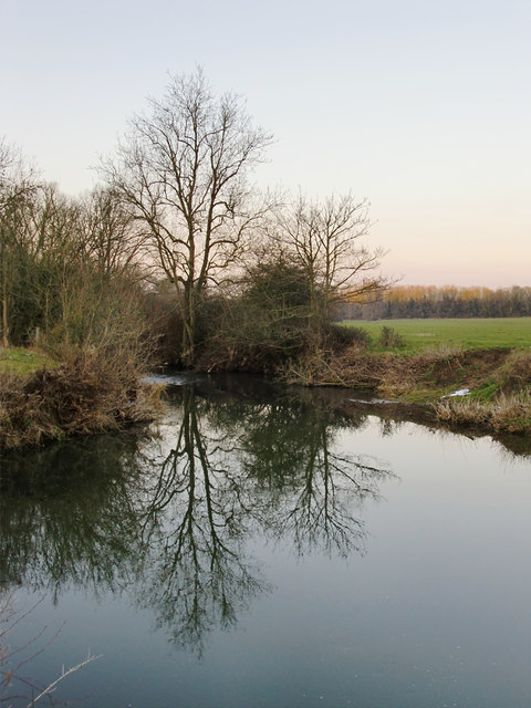
A pool along the course of the River Mole
The view is north, and downstream. At this point the river widens for a stretch, running very slowly - hence the reflections. A little further downstream, just past the tallest of the trees, the gradient of the river-bed steepens, and the stream runs more turbulently - as is just visible in this shot.
The river is flanked on both sides by pastureland, mostly grazing for horses.
The river is flanked on both sides by pastureland, mostly grazing for horses.
 Map © Crown Copyright")
TIP: Click the map for more Large scale mapping
- Grid Square
- TQ1654, 47 images (more nearby 🔍)
- Photographer
- Stefan Czapski (more nearby)
- Date Taken
- Friday, 10 February, 2012 (more nearby)
- Submitted
- Saturday, 11 February, 2012
- Subject Location
-
OSGB36:
 TQ 1645 5456 [10m precision]
WGS84: 51:16.6976N 0:19.9094W - Camera Location
-
OSGB36: TQ 1648 5452
- View Direction
- Northwest (about 315 degrees)