2012
NS4383 : Road junction
taken 12 years ago, near to Blairquhomrie, West Dunbartonshire, Scotland
This is 1 of 3 images, with title Road junction in this square
Road junction
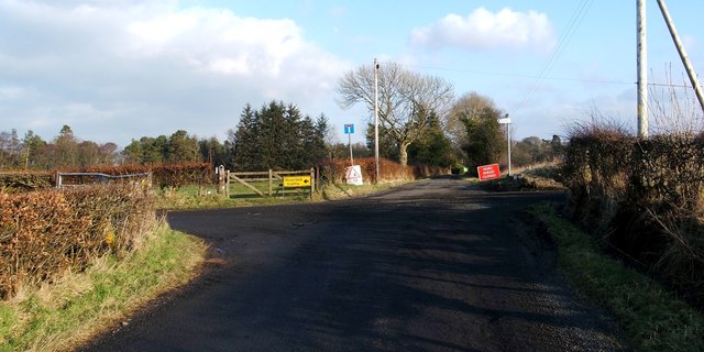
Auchincarroch Road appears in the foreground; it is part of a route known locally as the Horseshoe (NS3980 : One end of the Horseshoe). At this crossroads, that route continues to the left, and leads past NS4383 : Caldarvan Station to emerge, eventually, at Balloch (NS4083 : One end of the Horseshoe).
Straight ahead is NS4483 : The road to Wester Cameron. The track heading off to the right leads to NS4482 : Merkins Farm; see NS4482 : Track to Merkins Farm.
The diversion signs in the present photograph were needed because of a collapsed bridge: NS4483 : Site of destroyed Gallangad Bridge.
Straight ahead is NS4483 : The road to Wester Cameron. The track heading off to the right leads to NS4482 : Merkins Farm; see NS4482 : Track to Merkins Farm.
The diversion signs in the present photograph were needed because of a collapsed bridge: NS4483 : Site of destroyed Gallangad Bridge.
 Map © Crown Copyright")
TIP: Click the map for more Large scale mapping
- Grid Square
- NS4383, 26 images (more nearby 🔍)
- Photographer
- Lairich Rig (more nearby)
- Date Taken
- Friday, 3 February, 2012 (more nearby)
- Submitted
- Saturday, 11 February, 2012
- Subject Location
-
OSGB36:
 NS 4398 8307 [10m precision]
WGS84: 56:0.9048N 4:30.2634W - Camera Location
-
OSGB36: NS 4396 8307
- View Direction
- EAST (about 90 degrees)