2012
SO7971 : Footbridge over the Gladder Brook at its confluence with the River Severn, near Stourport-on-Severn
taken 12 years ago, near to Areley Kings, Worcestershire, England
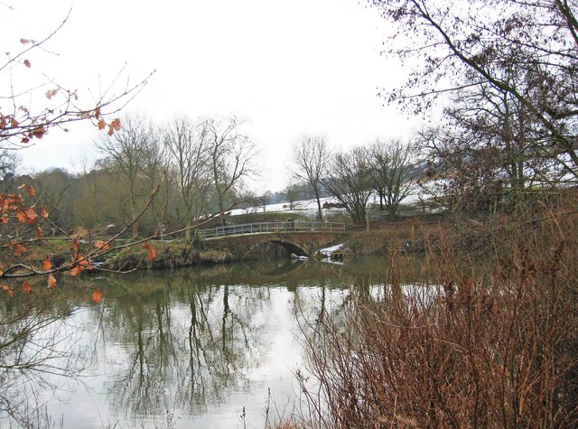
Footbridge over the Gladder Brook at its confluence with the River Severn, near Stourport-on-Severn
Around Stourport-on-Severm there are public footpaths on both sides of the River Severn. In this view across the river, a footbridge takes the footpath on the other side of the river across the Gladder Brook, at the point of its confluence with the River Severn. There was still a carpet of snow on the adjacent field. The name Gladder apparently comes from Anglo-Saxon and means clear.
 Map © Crown Copyright")
TIP: Click the map for more Large scale mapping
- Grid Square
- SO7971, 68 images (more nearby 🔍)
- Photographer
- P L Chadwick (more nearby)
- Date Taken
- Sunday, 12 February, 2012 (more nearby)
- Submitted
- Sunday, 12 February, 2012
- Subject Location
-
OSGB36:
 SO 798 713 [100m precision]
WGS84: 52:20.4128N 2:17.8571W - Camera Location
-
OSGB36: SO 798 714
- View Direction
- Southwest (about 225 degrees)