2011
SS9746 : Minehead - What Was That Grid Ref Again ?
taken 13 years ago, near to Minehead, Somerset, England
This is 1 of 2 images, with title starting with Minehead - What Was That Grid Ref in this square
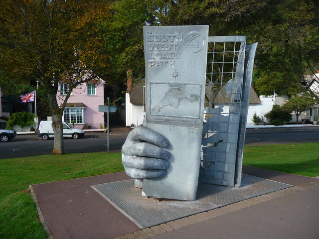
Minehead - What Was That Grid Ref Again ?
The start of the long distance South West Coastal Path.
 Map © Crown Copyright")
TIP: Click the map for more Large scale mapping
- Grid Square
- SS9746, 1055 images (more nearby 🔍)
- Photographer
- Chris Talbot (more nearby)
- Date Taken
- Thursday, 20 October, 2011 (more nearby)
- Submitted
- Monday, 13 February, 2012
- Subject Location
-
OSGB36:
 SS 971 468 [100m precision]
WGS84: 51:12.6662N 3:28.4709W - Camera Location
-
OSGB36: SS 971 468
- View Direction
- WEST (about 270 degrees)