1990
SJ4913 : Beacall's Lane and Shrewsbury Lancasterian School, 1990
taken 34 years ago, near to Shrewsbury, Shropshire, England
This is 1 of 2 images, with title starting with Beacall's Lane in this square
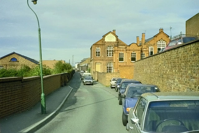
Beacall's Lane and Shrewsbury Lancasterian School, 1990
The school had closed in 1988. After this view, the inscription was changed to 'Shrewsbury British Schools' so presumably the building continued with some educational function.
 Map © Crown Copyright")
TIP: Click the map for more Large scale mapping
- Grid Square
- SJ4913, 468 images (more nearby 🔍)
- Photographer
- Robin Webster (more nearby)
- Date Taken
- Thursday, 27 September, 1990 (more nearby)
- Submitted
- Monday, 13 February, 2012
- Subject Location
-
OSGB36:
 SJ 4961 1308 [10m precision]
WGS84: 52:42.7813N 2:44.8402W - Camera Location
-
OSGB36: SJ 49573 13040
- View Direction
- Northeast (about 45 degrees)