1993
J3475 : Weir and cross-harbour bridges, Belfast (66)
taken 31 years ago, near to Belfast, Co Antrim, Northern Ireland
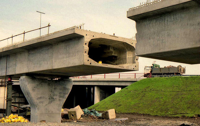
Weir and cross-harbour bridges, Belfast (66)
The scene between York Street and Dock Street (background) where the railway was making progress towards Yorkgate. The gap would be filled by a prefabricated section.
Building the Lagan weir and cross-harbour bridges, Belfast :: J3474
A collection of photographs showing the building of the Lagan weir and the cross-harbour road and railway bridges in the early 1990s. There are also some earlier shots of the pre-impounding River Lagan, of Donegall and Queens Quays, the Abercorn Basin and of the immediate area before demolition.
Loading map... (JavaScript required)
- Grid Square
- J3475, 773 images (more nearby 🔍)
- Photographer
- Albert Bridge (more nearby)
- Date Taken
- Saturday, 13 March, 1993 (more nearby)
- Submitted
- Tuesday, 14 February, 2012
- Subject Location
-
Irish:
 J 342 753 [100m precision]
WGS84: 54:36.5335N 5:55.4162W - Camera Location
-
Irish: J 341 753
- View Direction
- Northeast (about 45 degrees)