2012
NG3939 : Western end of Loch Duagrich
taken 12 years ago, 4 km ENE of Coillore, Isle of Skye, Scotland
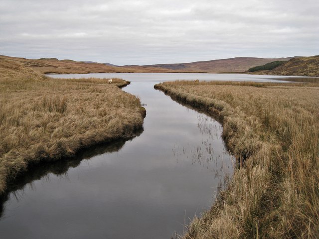
Western end of Loch Duagrich
Several burns come together to feed this deep channel which flows into the loch. There is a possible crossing point (for the fit and active) a hundred metres or so further west. See NG3939 : Cross here . Loch Duagrich is the largest natural freshwater loch on the Isle of Skye.
 Map © Crown Copyright")
TIP: Click the map for more Large scale mapping
- Grid Square
- NG3939, 12 images (more nearby 🔍)
- Photographer
- Richard Dorrell (more nearby)
- Date Taken
- Sunday, 12 February, 2012 (more nearby)
- Submitted
- Tuesday, 14 February, 2012
- Subject Location
-
OSGB36:
 NG 3935 3946 [10m precision]
WGS84: 57:22.2439N 6:20.2275W - Camera Location
-
OSGB36: NG 39314 39425
- View Direction
- Northeast (about 45 degrees)