2012
ST6167 : The Maes Knoll
taken 12 years ago, near to Whitchurch, Bath And North East Somerset, England
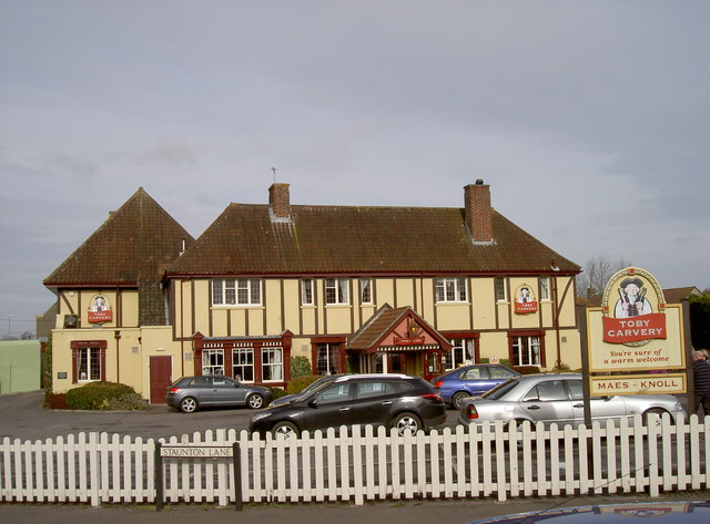
The Maes Knoll
The Toby inn renamed this eatery after the nearby hillfort on the eastern end of the Dundry ridge (see ST5966 : Profile for a view of it). Before that it was called the Black Lion, named after the landowning Lyons family who held a number of properties locally, including what is now known as Lyons Court Farm. That dates back to the thirteenth century. Prior to the current Black Lion, there was an older inn of the same name and another close by called the White Hart. Both were demolished to provide room for the new version in about 1850.
 Map © Crown Copyright")
TIP: Click the map for more Large scale mapping
- Grid Square
- ST6167, 157 images (more nearby 🔍)
- Photographer
- Neil Owen (more nearby)
- Date Taken
- Tuesday, 14 February, 2012 (more nearby)
- Submitted
- Monday, 20 February, 2012
- Subject Location
-
OSGB36:
 ST 6127 6765 [10m precision]
WGS84: 51:24.3926N 2:33.4922W - Camera Location
-
OSGB36: ST 6126 6761
- View Direction
- North-northeast (about 22 degrees)