2007
NM9785 : Dry stone wall crossing Sròn Liath
taken 17 years ago, near to Sròn Liath [hill or Mountain], Highland, Great Britain
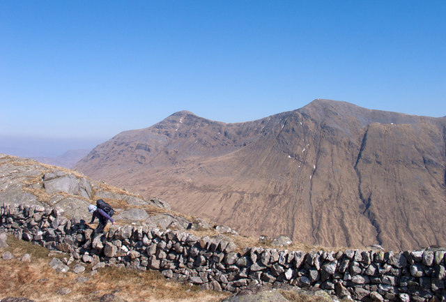
Dry stone wall crossing Sròn Liath
Sròn Liath is an intermediate top of the long ridge connecting Na h-Uamhachan with the Corbett, Bràigh nan Uamhachan. Countless man-hours will have been spent in gathering the stones then constructing the wall running for over a mile along the ridge and down into the glens on either side! The mountain beyond is the Munro, Gulvain/Gaor Bheinn.
 Map © Crown Copyright")
TIP: Click the map for more Large scale mapping
- Grid Square
- NM9785, 3 images (more nearby 🔍)
- Photographer
- Trevor Littlewood (more nearby)
- Date Taken
- Sunday, 1 April, 2007 (more nearby)
- Submitted
- Monday, 27 February, 2012
- Subject Location
-
OSGB36:
 NM 9730 8590 [10m precision]
WGS84: 56:55.1951N 5:19.9127W - Camera Location
-
OSGB36: NM 9728 8589
- View Direction
- Northeast (about 45 degrees)