2006
SK4163 : Seanor Lane, Lower Pilsley
taken 17 years ago, near to North Wingfield, Derbyshire, England
This is 1 of 8 images, with title starting with Seanor in this square
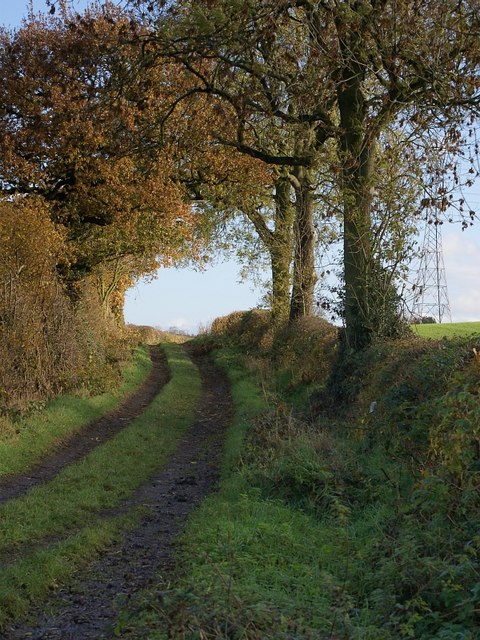
Seanor Lane, Lower Pilsley
The western end of Seanor Lane is metalled but, from Bridle Path Farm onward, the eastern end (part of which is seen here) is constructed of compacted stones and earth.
 Map © Crown Copyright")
TIP: Click the map for more Large scale mapping
- Grid Square
- SK4163, 98 images (more nearby 🔍)
- Photographer
- Nikki Mahadevan (more nearby)
- Date Taken
- Tuesday, 21 November, 2006 (more nearby)
- Submitted
- Tuesday, 21 November, 2006
- Subject Location
-
OSGB36:
 SK 417 639 [100m precision]
WGS84: 53:10.2352N 1:22.6587W - View Direction
- East-southeast (about 112 degrees)