2012
NT0928 : Wind turbines at Glenkerie wind farm
taken 12 years ago, 3 km from Hearthstane, Scottish Borders, Scotland
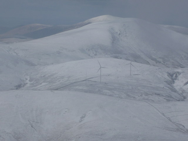
Wind turbines at Glenkerie wind farm
Taken from near the summit of Broad Law, several miles away. Gathersnow Hill and Culter Fell are behind the wind farm. The turbines are a bit better camouflaged than usual in the snow.
 Map © Crown Copyright")
TIP: Click the map for more Large scale mapping
- Grid Square
- NT0928, 11 images (more nearby 🔍)
- Photographer
- Alan O'Dowd (more nearby)
- Date Taken
- Sunday, 4 March, 2012 (more nearby)
- Submitted
- Sunday, 4 March, 2012
- Subject Location
-
OSGB36:
 NT 095 285 [100m precision]
WGS84: 55:32.5235N 3:26.1341W - Camera Location
-
OSGB36: NT 146 237
- View Direction
- Northwest (about 315 degrees)