TM3499 : Swampy ground by the northern tip of Sisland Carr
taken 12 years ago, near to Sisland, Norfolk, England
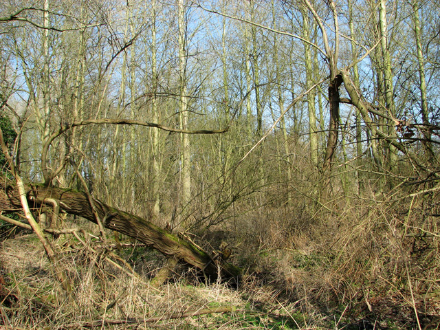
Sisland Carr is located in the arable farmlands of South Norfolk near Chedgrave and Loddon. In the area are small fragmented remains of old mixed woodland, Sisland Carr can be considered the largest remaining when put in this context. The wood's neighbour to the west is the local sewage works, and to the east, the small river Chet.
Sisland Carr is made up of 8.1 Ha mixed secondary woodland and 3.64 Ha wet meadow TM3499 : Orchid flowers.
The woodlands structure consists of a 3 Ha conifer plantation dominated by Scots pine bordered with a small, area of Corsican. The broadleaved areas were planted following severe wind damage in 1987. Mature specimens of Beech, Oak and Silver Birch are also frequent within the broadleaved sections. To the North area Alder Carr is found on the boggier grounds along with mature poplars. The odd muntjac deer has been sighted within the woodland areas and wetlands.
Unfortunately ground flora is rather poor, being mostly made up of Bracken and Brambles. However in the spring and summer the area near the carpark consists of dense Bluebells along with a small isolated concentration of Dogs Mercury and Town hall clock. In darker areas of shade male fern is frequent, due to the local geology of poor sandy soils that cover most of the site. The meadow beside to wood is an excellent habitat for wild flowers including orchids. The management being low intensity grazing in March and October, roughly 40 sheep are employed on this duty.
Today it is privately owned but is managed by the woodland trust and local volunteers. The access road is poor in wet conditions. There are many easy paths throughout the wood and meadows. You can often have the place to yourself.
 Map © Crown Copyright")
- Grid Square
- TM3499, 128 images (more nearby 🔍)
- Photographer
- Evelyn Simak (more nearby)
- Date Taken
- Sunday, 11 March, 2012 (more nearby)
- Submitted
- Sunday, 11 March, 2012
- Subject Location
-
OSGB36:
 TM 3434 9952 [10m precision]
WGS84: 52:32.5840N 1:27.2700E - Camera Location
-
OSGB36: TM 3433 9947
- View Direction
- NORTH (about 0 degrees)