2011
SJ8293 : Mauldeth Road West, Hough End
taken 12 years ago, near to Withington, Manchester, England
This is 1 of 2 images, with title Mauldeth Road West, Hough End in this square
Mauldeth Road West, Hough End
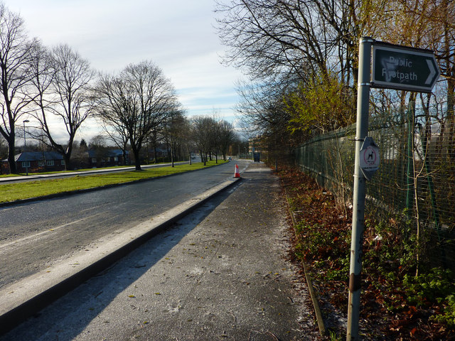
From the top of Twenty-Seven Steps, near the railway bridge. This wide dual carriageway was constructed in the late 1920s (replacing a narrower lane that passed Hough End Hall), and connected to a widened Hardy Lane, which terminated at Hardy Farm, some way north of the foot crossing over the Mersey at Jackson's Boat. An extension of Hardy Lane was planned, but never constructed. As a result, even today, the road carries much less traffic than it was built to take.
The central reservation was reserved for tram tracks which, as far as I know, were never laid. However just after the last tree seen in this view, the planned Metrolink line towards Manchester Airport will join from the right, and run along the centre of the road to its junction with Barlow Moor Road / Hardy Lane
The central reservation was reserved for tram tracks which, as far as I know, were never laid. However just after the last tree seen in this view, the planned Metrolink line towards Manchester Airport will join from the right, and run along the centre of the road to its junction with Barlow Moor Road / Hardy Lane
 Map © Crown Copyright")
TIP: Click the map for more Large scale mapping
- Grid Square
- SJ8293, 149 images (more nearby 🔍)
- Photographer
- Phil Champion (more nearby)
- Date Taken
- Sunday, 18 December, 2011 (more nearby)
- Submitted
- Wednesday, 14 March, 2012
- Subject Location
-
OSGB36:
 SJ 8271 9340 [10m precision]
WGS84: 53:26.2254N 2:15.7038W - Camera Location
-
OSGB36: SJ 8271 9340
- View Direction
- Southwest (about 225 degrees)