1997
SJ6941 : View over the Cheshire Plain, from the rising land to the south
taken 27 years ago, near to Buerton, Cheshire East, England
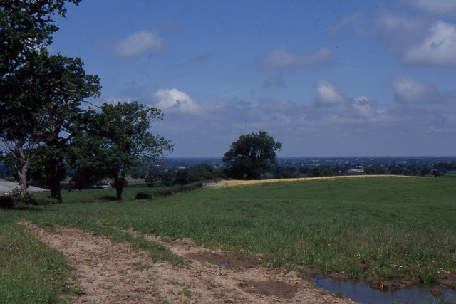
View over the Cheshire Plain, from the rising land to the south
As Cheshire gives way to Shropshire and Staffordshire, the land rises out of the Cheshire Plain to more rolling countryside (something symbolised in this part of the county by the 15 Audlem locks that carry the canal off the plain and into Shropshire). This view is taken off Woodhouse Lane, which runs over the little hills between Audlem and Norton-in-Hales - to the left are buildings at Holly Farm, whilst to the right, down the hill, is Hankins Heys. The structure on the horizon is the radio telescope at Jodrell Bank, visible quite distinctly on a clear day from up here.
 Map © Crown Copyright")
TIP: Click the map for more Large scale mapping
- Grid Square
- SJ6941, 5 images (more nearby 🔍)
- Photographer
- Christopher Hilton (more nearby)
- Date Taken
- Sunday, 6 July, 1997 (more nearby)
- Submitted
- Wednesday, 28 March, 2012
- Subject Location
-
OSGB36:
 SJ 6908 4131 [10m precision]
WGS84: 52:58.0950N 2:27.7099W - Camera Location
-
OSGB36: SJ 6900 4116
- View Direction
- North-northeast (about 22 degrees)