2012
SD5805 : The Shepherds Arms
taken 12 years ago, near to Wigan, England
This is 1 of 2 images, with title starting with The Shepherds in this square
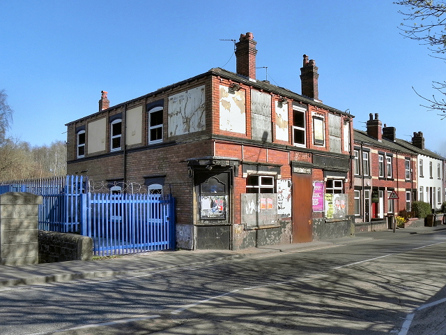
The Shepherds Arms
Derelict public house on Warrington Road (A573) next to Britannia Bridge. SD5805 : The Shepherds Arms Inn Sign is the only thing left by which to identify it.
 Map © Crown Copyright")
TIP: Click the map for more Large scale mapping
- Grid Square
- SD5805, 835 images (more nearby 🔍)
- Photographer
- David Dixon (more nearby)
- Date Taken
- Wednesday, 28 March, 2012 (more nearby)
- Submitted
- Thursday, 29 March, 2012
- Subject Location
-
OSGB36:
 SD 5884 0507 [10m precision]
WGS84: 53:32.4391N 2:37.3536W - Camera Location
-
OSGB36: SD 5882 0507
- View Direction
- EAST (about 90 degrees)