2006
NJ5841 : Round Tower
taken 17 years ago, near to Drumblade, Aberdeenshire, Scotland
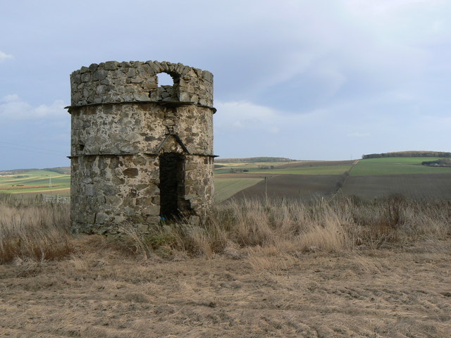
Round Tower
Standing prominently on a hill to the west of Meikleton Farm, this tower is marked on O.S. maps as a Doocot, but is of rather an unusual design.
 Map © Crown Copyright")
TIP: Click the map for more Large scale mapping
- Grid Square
- NJ5841, 11 images (more nearby 🔍)
- Photographer
- James Allan (more nearby)
- Date Taken
- Thursday, 30 November, 2006 (more nearby)
- Submitted
- Friday, 1 December, 2006
- Subject Location
-
OSGB36:
 NJ 583 414 [100m precision]
WGS84: 57:27.6574N 2:41.8019W - Camera Location
-
OSGB36: NJ 582 413
- View Direction
- Northeast (about 45 degrees)