2011
ST1794 : Gelligroes Mill, Pontllanfraith
taken 13 years ago, near to Wyllie, Caerphilly/Caerffili, Wales
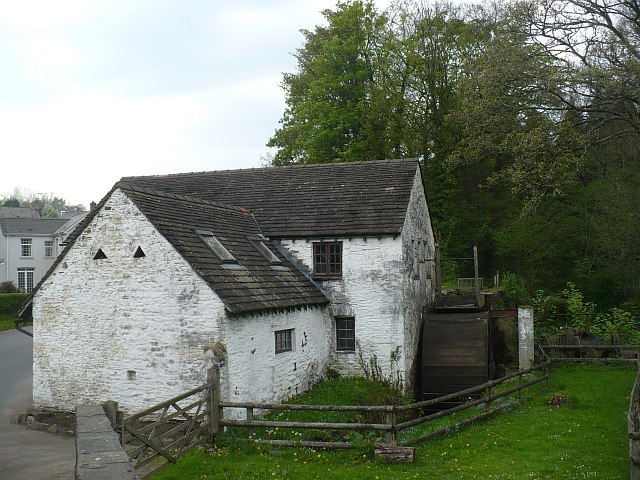
Gelligroes Mill, Pontllanfraith
Dating from the 17th century, it is Grade II* listed.
For its connection with the sinking of the Titanic see Link .
For its connection with the sinking of the Titanic see Link .
 Map © Crown Copyright")
TIP: Click the map for more Large scale mapping
- Grid Square
- ST1794, 90 images (more nearby 🔍)
- Photographer
- Robin Drayton (more nearby)
- Date Taken
- Friday, 22 April, 2011 (more nearby)
- Submitted
- Tuesday, 10 April, 2012
- Subject Location
-
OSGB36:
 ST 1778 9471 [10m precision]
WGS84: 51:38.7092N 3:11.3802W - Camera Location
-
OSGB36: ST 1777 9470
- View Direction
- Northeast (about 45 degrees)