2012
J4052 : Lyon's Bridge near Crossgar (2)
taken 12 years ago, 4 km NNE of Drumaness, Co Down, Northern Ireland
Lyon's Bridge near Crossgar (2)
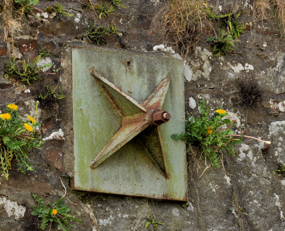
The bridge has been strengthened in the not too distant past. This reinforcing (no makers name visible) is on the eastern side. The Google map and the satellite photograph do not coincide. I have used the map.
Lyon's Bridge, near Crossgar
A single-arch stone bridge carrying the minor Raleagh Road across the Ballynahinch River. Date of building unknown but it might be reasonable to suggest some time in the early/mid 18th century.
Manhole covers, foundry products etc, Northern Ireland
A series of photographs showing manhole covers, fire hydrants, gratings, foundry products, foundry plaques and inscriptions etc, in Northern Ireland.
Loading map... (JavaScript required)
- Grid Square
- J4052, 7 images (more nearby 🔍)
- Photographer
- Albert Bridge (more nearby)
- Date Taken
- Thursday, 12 April, 2012 (more nearby)
- Submitted
- Thursday, 12 April, 2012
- Subject Location
-
Irish:
 J 409 521 [100m precision]
WGS84: 54:23.9110N 5:49.7903W - Camera Location
-
Irish: J 410 521
- View Direction
- West-northwest (about 292 degrees)