2012
SX4350 : The Institute, Kingsand
taken 12 years ago, near to Kingsand, Cornwall, England
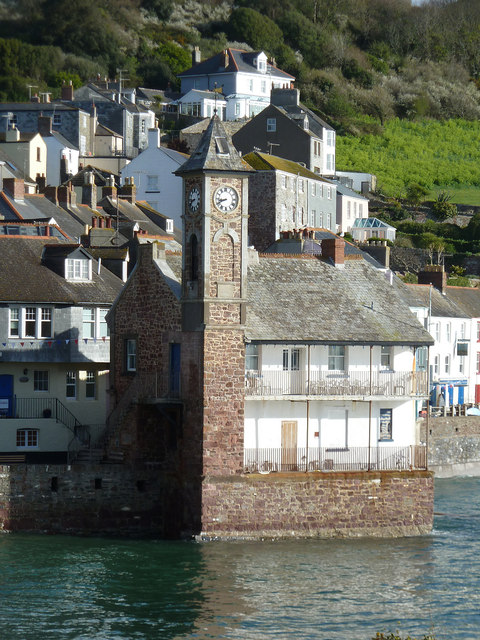
The Institute, Kingsand
The Institute in Kingsand was built in 1911 to celebrate the coronation of King George V - its clocktower being a famous local landmark. There are photos showing waves crashing so hard in this bay that a great volume of spray is seen going over the top of the clocktower. Such a photo used to be in the nearby Halfway House PH, but I'm not sure if it's still there.
The twin villages of Kingsand and Cawsand seamlessly merge with one another, but historically Kingsand was in Devon, while Cawsand was in Cornwall. In 1844 however the boundary was redrawn along the Tamar and Kingsand returned to Cornwall.
For a slightly different view taken 21 months later see SX4350 : Kingsand - The Institute - still intact
 Map © Crown Copyright")
TIP: Click the map for more Large scale mapping
- Grid Square
- SX4350, 285 images (more nearby 🔍)
- Photographer
- Rob Farrow (more nearby)
- Date Taken
- Tuesday, 10 April, 2012 (more nearby)
- Submitted
- Tuesday, 17 April, 2012
- Subject Location
-
OSGB36:
 SX 4347 5047 [10m precision]
WGS84: 50:19.9986N 4:12.0454W - Camera Location
-
OSGB36: SX 4345 5036
- View Direction
- NORTH (about 0 degrees)