2012
NZ1158 : Gateshead West Community Fire Station, Chopwell
taken 12 years ago, near to Chopwell, Gateshead, England
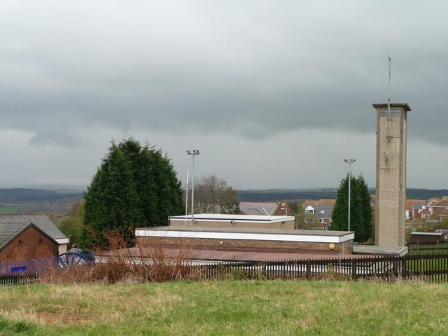
Gateshead West Community Fire Station, Chopwell
Built in the 1970s as Chopwell Community Fire Station. Chopwell was categorised as a "category D village" by Durham County Council. With the decline of coal-mining locally, 114 villages were classified in this way in 1951, and another seven in 1964, including Chopwell. They were left to wither and die, without economic assistance or development. The policy ended in 1977, but many still have an old fashioned air, contrasting with newer areas of commuter housing.
 Map © Crown Copyright")
TIP: Click the map for more Large scale mapping
- Grid Square
- NZ1158, 35 images (more nearby 🔍)
- Photographer
- Christine Johnstone (more nearby)
- Date Taken
- Thursday, 12 April, 2012 (more nearby)
- Submitted
- Tuesday, 17 April, 2012
- Subject Location
-
OSGB36:
 NZ 1181 5828 [10m precision]
WGS84: 54:55.1449N 1:49.0370W - Camera Location
-
OSGB36: NZ 1186 5830
- View Direction
- West-southwest (about 247 degrees)