2012
TR3645 : Kingsdown Road - end of the village
taken 12 years ago, near to St Margaret's at Cliffe, Kent, England
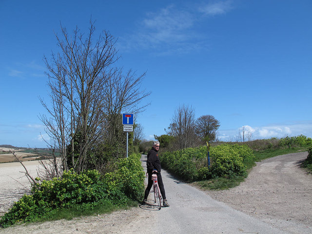
Kingsdown Road - end of the village
Kingsdown Road continues beyond this point (the 81m spot height at the northern end of St Margaret-at-Cliffe) but the surface becomes rougher and there is a sign warning it is a dead-end except for cycles (due to a barrier further on TR3646 : Gate on the track on Otty Bottom ).
 Map © Crown Copyright")
TIP: Click the map for more Large scale mapping
- Grid Square
- TR3645, 50 images (more nearby 🔍)
- Photographer
- Stephen Craven (more nearby)
- Date Taken
- Sunday, 15 April, 2012 (more nearby)
- Submitted
- Wednesday, 18 April, 2012
- Subject Location
-
OSGB36:
 TR 3611 4527 [10m precision]
WGS84: 51:9.4761N 1:22.5156E - Camera Location
-
OSGB36: TR 3611 4526
- View Direction
- Northeast (about 45 degrees)