2012
SD7058 : Hodderside pasture
taken 12 years ago, near to White Syke [water Feature], Lancashire, Great Britain
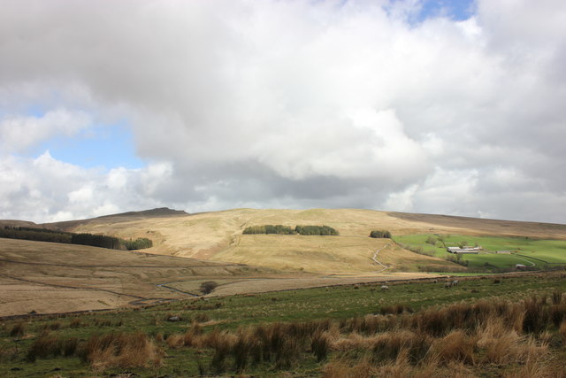
Hodderside pasture
The last upland (rough) pasture before the moorland proper beyond the C of G bridge. Catlow Farm visible on the opposite bank. Bowland Knotts high on the skyline.
 Map © Crown Copyright")
TIP: Click the map for more Large scale mapping
- Grid Square
- SD7058, 29 images (more nearby 🔍)
- Photographer
- Peter Turner (more nearby)
- Date Taken
- Tuesday, 10 April, 2012 (more nearby)
- Submitted
- Wednesday, 25 April, 2012
- Subject Location
-
OSGB36:
 SD 7091 5881 [10m precision]
WGS84: 54:1.4676N 2:26.7315W - Camera Location
-
OSGB36: SD 7051 5872
- View Direction
- East-northeast (about 67 degrees)