TQ4692 : Oaks on forest boundary
taken 12 years ago, near to Hainault, Redbridge, England
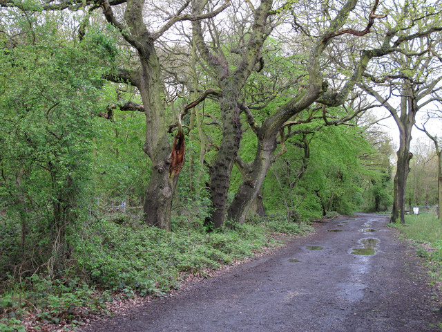
The deciduous trees nearest us are oak trees.
Hainault Forest is managed by the Woodland Trust. It adjoins more open land owned by the London Borough of Redbridge and these 2 sections form Hainault Forest Country Park.
It is a remnant of what was once the Forest of Essex, a former hunting forest created to provide venison for the crown.
For more info from the Woodland Trust see Link
For geograph pictures of the Country Park see here Link
For more info on the Country Park see Link
Once a royal forest much was laid to waste following an Act of Parliament in 1851 which authorised the cutting down and removal of the trees. This devastation led a local politician, Edward North Buxton, and local people to set about saving the forest. It is now owned and managed by the Woodland Trust. The forest consists of hornbeam pollards, oaks and ash trees. Hainault is a unique site as it features open heathland some of which has been planted up and the dense woodland of the ancient forest.
 Map © Crown Copyright")
- Grid Square
- TQ4692, 29 images (more nearby 🔍)
- Photographer
- Roger Jones (more nearby)
- Date Taken
- Sunday, 29 April, 2012 (more nearby)
- Submitted
- Monday, 30 April, 2012
- Subject Location
-
OSGB36:
 TQ 46995 92966 [1m precision]
WGS84: 51:36.9800N 0:7.3054E - Camera Location
-
OSGB36: TQ 46985 92956
- View Direction
- Northeast (about 45 degrees)