2005
SJ6689 : Wheat field
taken 19 years ago, near to Martinscroft, Warrington, England
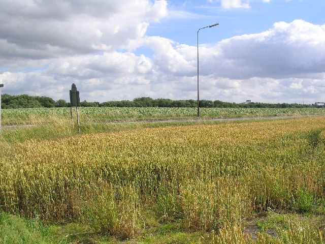
Wheat field
This shot is a view across two fields, the near field is of wheat and the field behind is potatoes. The fields are divided by the A57 as it passes from J21 of the M6 towards Rixton. The photo was taken from SJ667893 looking SW towards the M6, some the overhead signs can be seen in the distance.
 Map © Crown Copyright")
TIP: Click the map for more Large scale mapping
- Grid Square
- SJ6689, 25 images (more nearby 🔍)
- Photographer
- Dave Smethurst (more nearby)
- Date Taken
- Wednesday, 20 July, 2005 (more nearby)
- Submitted
- Thursday, 21 July, 2005
- Subject Location
-
OSGB36:
 SJ 667 893 [100m precision]
WGS84: 53:23.9681N 2:30.1371W