2006
TR3440 : Southern Breakwater, Dover Harbour
taken 17 years ago, near to Dover, Kent, England
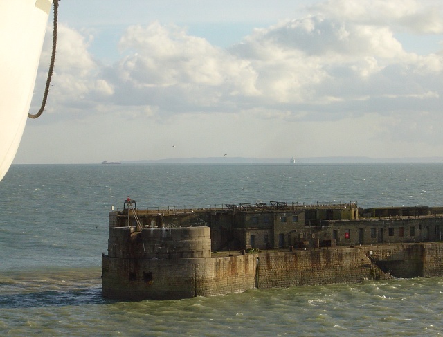
Southern Breakwater, Dover Harbour
The white bulk top left is a lifeboat on the SeaFrance ferry, "Rodin"; the greyish bulk clearly discernible on the distant horizon is the northern coast of France near Calais (can I earmark this pic for submission to geographe.org.fr when it happens?); the main brownish bulk in the foreground is the detached Southern Breakwater, completed in 1909 and only accessible by boat. The weather was beautiful, but just a few hours later, on our return, we were tossed about on the waves, and struggled to make our berth.
 Map © Crown Copyright")
TIP: Click the map for more Large scale mapping
- Grid Square
- TR3440, 20 images (more nearby 🔍)
- Photographer
- Hugh Chevallier (more nearby)
- Date Taken
- Sunday, 10 December, 2006 (more nearby)
- Submitted
- Wednesday, 13 December, 2006
- Subject Location
-
OSGB36:
 TR 340 408 [100m precision]
WGS84: 51:7.1205N 1:20.5343E - Camera Location
-
OSGB36: TR 340 409
- View Direction
- Southeast (about 135 degrees)